The site – a sustainable, infill location for sensitive growth
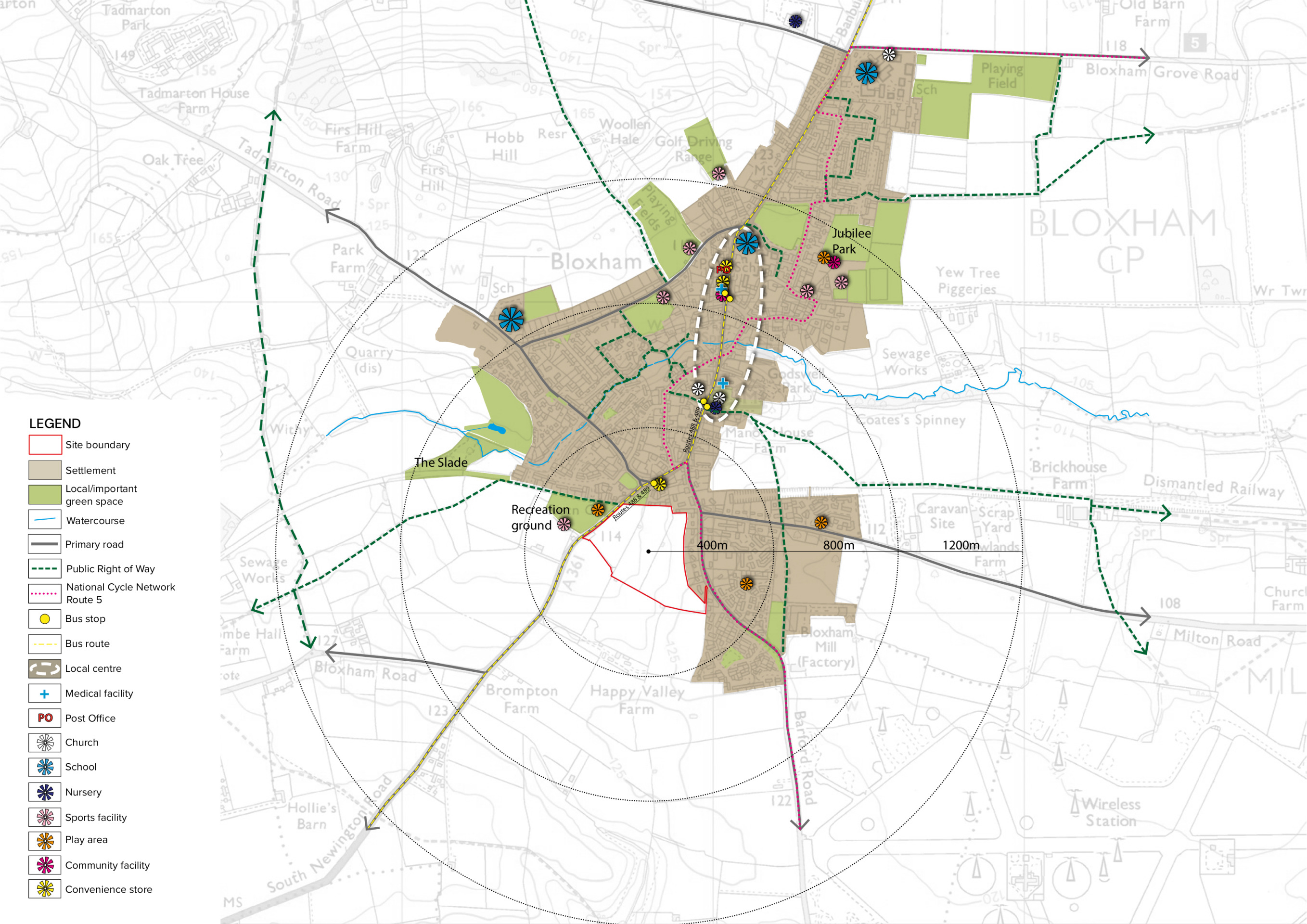
The site extends to approximately 7.8 hectares (ha) and occupies a highly sustainable location on the southern edge of Bloxham. It is situated on the eastern side of South Newington Road, opposite the Recreation Ground. The village centre with its various services and facilities is located within 600m of the north of the site, with excellent access on foot, bicycle or by existing bus routes.
There are existing residential properties immediately adjacent to the site to both the east and the north, while the west is South Newington Road with the recreation ground beyond. As such, the site represents a logical extension to the existing built form of the southern edge of Bloxham.
The site’s southern boundary comprises a belt of trees and hedgerows separating the site from the open countryside to the south. There are opportunities to further enhance this green buffer with additional landscaping, creating a robust, logical and defensible new southern boundary of the village. Landscape features within the site, such as hedgerow, trees and ponds, will be retained and enhanced with additional landscape planting as part of a sensitive, landscape-led residential development.
Planning policy – Why we are bringing forward these proposals
Cherwell District Council’s existing Local Plan was adopted in July 2015. The Local Plan identifies Bloxham as a Category A village, which are defined as “service centres”, playing a key role in supporting surrounding “satellite villages” by providing day-to-day services and facilities.
The Government requires local authorities to undertake a full review of the Local Plan every five years. Cherwell District Council is in the early stages of preparing a new Local Plan and has targeted December 2025 for the adoption of the new Local Plan, more than 10 years since the extant Local Plan was adopted.
This will leave the District without an up-to-date Local Plan for a number of years, meaning no residential allocations will be identified to address the existing housing shortfall in the District. Recent appeal decisions have also determined that the Council is unable to demonstrate a five-year housing land supply, leaving it at risk of speculative development proposals in potentially unsuitable locations.
William Davis Homes is promoting the site off South Newington Road for inclusion in Cherwell District Council’s emerging Local Plan, as it represents a sustainable and suitable location to meet the District’s Housing Needs.
Many other sites are currently being promoted through the Local Plan, some at far less sustainable locations. Some of these are being promoted by housebuilders, while others by strategic land promoters who would then sell the site on to be delivered by other developers. This is likely to include sites elsewhere around Bloxham.
The site off South Newington Road is the most sustainable and suitable site in Bloxham to make a contribution to the District’s housing needs. Bringing forward our proposals now, while continuing to promote them through the Local Plan, provides an opportunity for the local community to get involved in identifying potential opportunities for investment into village infrastructure to be delivered by the development, while giving them the certainty of knowing that the development will be delivered by William Davis Homes, a high-quality, family-owned housebuilder. This in turn will enable early delivery of much-needed new homes in the Local Plan period, protecting unsuitable locations around the village and the wider District from less sustainable development.
What is a Local Plan?
A Local Plan is a document that sets out the vision for future development in a local authority area. Government requires that all local authorities have an up-to-date local plan in place and review it at least every five years.
The existing Cherwell District Local Plan was adopted by the Council in 2015 following extensive consultation. Cherwell District Council is in the early stages of preparing a new Local Plan and has targeted December 2025 for the adoption of the new Local Plan, more than 10 years since the extant Local Plan was adopted.
You can find out more about the Cherwell District Local Plan here: https://www.cherwell.gov.uk/info/83/local-plans/729/local-plan-review-2040---planning-for-cherwell-to-2040.
Understanding the site – How we have analysed the site and its surroundings to inform our emerging vision
We have carefully considered the site’s features and the surrounding context to ensure that development takes into account key sensitivities and is designed to integrate with the surrounding landscape. The plan below shows some of the key features, opportunities and constraints that have helped inform potential layouts for a landscape-led new neighbourhood that is sensitive to its surroundings. Considerations include:
- Careful consideration of the site’s boundaries to ensure the development successfully integrates with its surroundings and limits its impact on the landscape and visual amenity and nearby Conservation Area and Listed Buildings.
- Existing vegetation along the site boundaries and internal hedgerow corridors should be retained and enhanced with additional planting, forming a landscape framework within which development could sit.
- These existing hedgerow corridors, ditches and ponds provide opportunities for a network of diverse green corridors through the site.
- South Newington Road provides an opportunity for safe and convenient site access connecting to the wider highways network.
- Barford Road provides an opportunity for safe and convenient pedestrian/cycle access connecting to the wider network, including the National Cycle Network.
- A suitable and well-integrated sustainable drainage system (SUDS) should be designed to accommodate surface water on site, with development set back from the very limited areas where surface water flood risk exists on the western boundary.
- The proximity of existing dwellings to the north and east should be considered through the offsetting of development, longer gardens, and additional buffer planting where appropriate.
- Due to existing ground levels the site will require a pumping station alongside South Newington Road.
A detailed site synthesis plan, showing key features, opportunities and constraints to inform development proposals - click to enlarge
Our emerging vision for a high-quality, landscape-led residential development in Bloxham
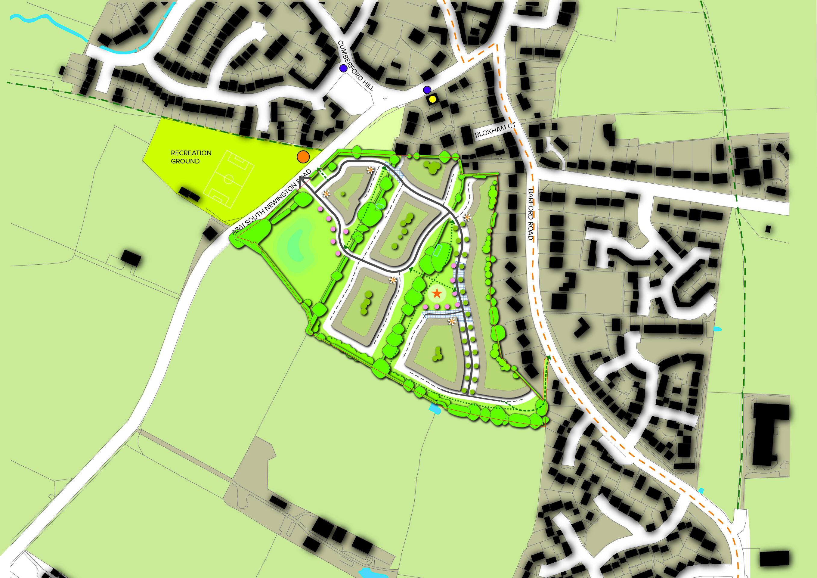
The proposals being prepared by William Davis Homes, are for a landscape-led development of approximately 165 new homes, including affordable homes and the potential to include level access homes and bungalows for residents with limited mobility.
The quality family homes would be set amongst extensive areas of green open space, including retained trees and hedgerows both within the site and around the site’s perimeter, alongside additional planting to enhance the landscape setting. The retention of existing landscape features, along with the planting of new trees, including within public open space, tree-lined internal streets and within gardens, will screen the new neighbourhood from the wider landscape enabling the new homes to sit sensitively within their surroundings.
The landscape-led approach will help to respect the character and setting of the conservation area to the north, particularly through the offsetting of development along South Newington Road and the retention of the boundary hedgerows in this location.
Where areas of development back on to existing residential properties on Barford Road and to the north, there will additional landscape planting and the incorporation of longer gardens, to protect the residential amenity of existing and new residents.
The retention of green corridors and extensive public open spaces will allow for a network of pedestrian links through the new neighbourhood. A play area for children is proposed centrally within the neighbourhood.
Our concept design showing how a new neighbourhood of circa 165 new homes could look. Please note this may evolve in response to consultation feedback and technical studies as the plans progress - click to open the interactive map
Site access and movement
Vehicular access to the site will be provided via a priority controlled junction from South Newington Road, which will incorporate pedestrian crossings. A separate 4m wide access a short distance north of the primary access to provide dedicated cycle and pedestrian access, while also serving as an emergency access. A new footpath will be provided from the primary access along the north-western boundary of the site to link with the existing bus stop and the recreation ground, providing safe and convenient access to these facilities and to the village by foot.
In the southeast corner of the site, an existing 4m wide right of way access will be improved to provide pedestrian and cycle access from Barford Road, providing a direct link from the development with National Cycle Network Route 5 which runs along Barford Road. Within the new neighbourhood there will be a network of pedestrian and cycle routes, set with the extensive areas of public open space.
As a result of these proposals and the sustainable location of the site, there will be excellent active travel connectivity with the village centre.
The outline planning application will be accompanied by a Transport Assessment which has been informed by a scoping exercise with the local highways authority (Oxfordshire County Council Highways). This confirms that there will be no significant impact on the local highways network.
Site design concept - click to enlarge
The development will provide a direct cycle link with National Cycle Network Route 5 on Barford Road - click to enlarge
Green infrastructure and ecology – A sensitive development delivering Biodiversity Net Gain
As a landscape-led development, the new neighbourhood will be set within a framework of green corridors and mature trees, with existing hedgerows, trees, ditches and ponds retained and enhanced, providing a network of green spaces for walking, amenity and habitat creation. In addition, the existing hedgerows and trees around the site’s perimeter will also be retained and enhanced, providing significant landscape buffering and helping the neighbourhood to integrate into the surrounding landscape.
This retention of existing landscape features and creation and management of new landscape planting and Sustainable Urban Drainage System (SUDS) features within the site will provide new habitats and enhance the quality of the existing habitats, improving the biodiversity in the site.
An Ecological Impact Appraisal is being prepared to support the outline planning application and inform the finer details of ecological mitigation. The landscape-led approach taken by the proposals will deliver net gains in biodiversity in line with policy and guidance.
An existing William Davis Homes development, with extensive areas of landscaped green open space - click to enlarge
Sustainability
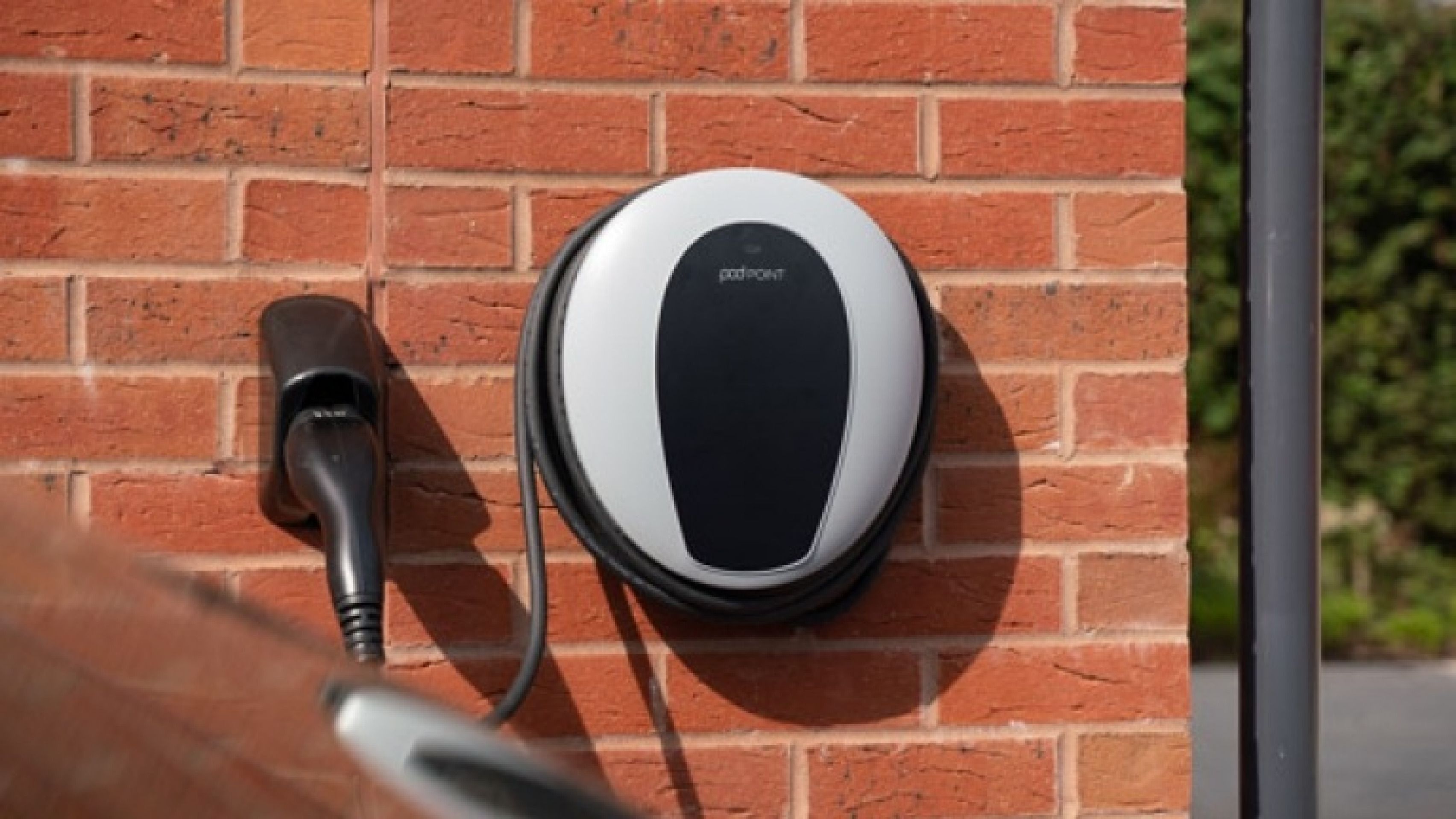
WWilliam Davis Homes is a high-quality, family-owned housebuilder. Their homes are designed with energy efficiency in mind and come fitted with energy efficient boilers, a state-of-the-art HIVE smart system, and improved levels of fabric thermal efficiency including walls, glazing, floors and roofs. It anticipated that the new homes will also include measures such as PV cells (solar panels) and EV charging infrastructure. As standard, William Davis Homes places 50% more cavity wall insulation in properties than is required under Building Regulations, to maximise energy efficiency.
In addition to the landscape-led approach for this development, William Davis developments also incorporate bat and bird boxes where appropriate, along with specifically designed barn owl houses to protect and encourage wildlife and to create semi-rural settings and attractive environments to homeowners.
To reduce their carbon footprint, William Davis Homes sources materials and labour locally as much as possible, with 87% of their materials come from suppliers based in central England.
Heritage and archaeology – An opportunity for growth without impacting Bloxham Conservation Area
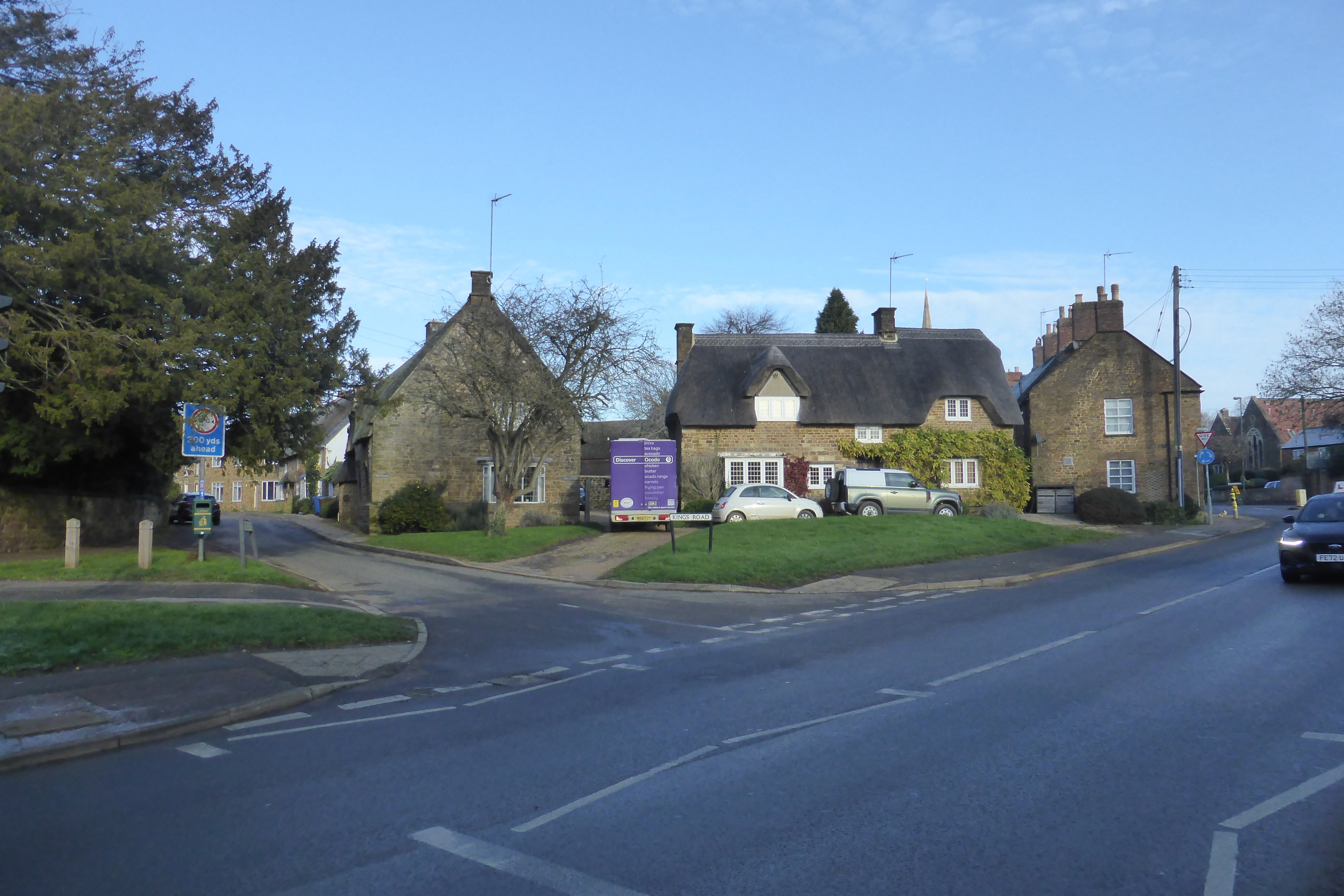
The emerging proposals for the new neighbourhood off South Newington Road have been informed by a Historic Environment Desk-Based Assessment (HEDBA). The edge of Bloxham Conservation Area and two Grade II Listed Buildings lie a short distance to the north of the site. However, unlike other potential development locations in Bloxham, the new neighbourhood is separated from the Conservation Area by a green buffer to the northwest, and by existing development to the north, and has little intervisibility with it. Furthermore, the development will be set back from the South Newington Road frontage, with existing hedgerows and trees retained, respecting the approach to the Conservation Area from the south.
The HEDBA concludes that the site is considered to have low archaeological potential for all periods and that there is no evidence to suggest the presence of historical assets or archaeological remains of sufficient importance that would constrain or prevent development of the site.
Unlike other sites that may be being promoted for development in Bloxham, the site is separated from Bloxham’s Conservation Area and has little invisibility with it - click to enlarge
Flooding and drainage
A Flood Risk Assessment (FRA) has been undertaken and confirms that the entirety of the site falls within Flood Zone 1, meaning it is at ‘very low risk’ of flooding.
In terms of surface water flood risk, the FRA confirms that the majority of the site has been identified as being at very low risk. Small areas that are at risk of surface water flooding have been identified at the site’s western boundary and this will be mitigated by the layout proposals avoiding development in these areas and by the proposed surface water drainage scheme for the new neighbourhood.
The Masterplan incorporates a green corridor at the site’s western boundary and a drainage basin at the lowest point of the site at its south-west. A culvert is proposed under the site access at South Newington Road to accommodate a surface water overland flow pathway.
A pumping station to transport sewage to an existing sewer connection along South Newington Road will be delivered at the site’s southwestern corner.
Opportunities for investment in the wider community
The development of a high-quality, landscape-led neighbourhood of family homes off South Newington Road will generate significant financial contributions to be invested into local infrastructure. Although these will be determined through statutory consultation carried out by the local planning authority (Cherwell District Council) with bodies such as the local education authority, local NHS Integrated Care Board (formerly Clinical Commissioning Group), utilities and others, we want to understand the aspirations of the community in Bloxham as to where they would like to see investment. For example:
- Given the site’s proximity to the Recreation Ground, there may be opportunities for investment into facilities at the Ground.
- Are there facilities within the village that require investment or enhancement?
- Are there any infrastructure requirements in the village that we should consider?
We will use this pre-application consultation with the community and Parish Council, as well as ongoing engagement through the planning process, to understand community aspirations for the investments they would like to see from development.
Please take a moment to complete our online questionnaire to let us know your priorities for Bloxham.


